Badger

Badger

Iron Bark II

Iron Bark II

About Me

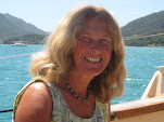
My photo
I first crossed the Atlantic in 1975 on 'Stormalong', a 28ft Wharram-designed catamaran. Back in the UK, Pete and I bought an ex 6-metre racing yacht, 'Sheila', living on her for 4 years. Wanting to do more and go further, we built 'Badger' - the best boat in the world - sailing her 110,000 miles, to the Arctic and the Antarctic, around the Atlantic North and South and into the Baltic. She had junk rig - the only rig I will ever now cruise with. Pete wanted to build a 38 ft junk-rigged catamaran, 'China Moon' - which he designed. But before the project was finished, we went our separate ways. A year later I joined Trevor Robertson aboard his 35ft 'Iron Bark'. We explored the Canadian Maritimes, crossed the Atlantic twice, wintered in Greenland and crossed the Pacific to Australia and New Zealand. I fell in love with NZ and jumping ship, bought my own boat while Trevor carried on voyaging. I put a junk rig onto ‘Fantail’ and, having decided that N Island offered better cruising opportunities than S Island, sailed up there in 2012. Looking for a boat to see me out, I built the 26ft 'FanShi' and now live on board her, pottering about, generally around the Bay of Islands.

Friday, 27 March 2009

GOUGH ISLAND
40°21'S 9°52'W
Chart 1769: Gough Island
H M Admiralty Pilot, Africa Vol ii

Gough Island lies just in the Roaring Forties and is 230 miles SSE of Tristan de Cunha. It is a dependency of St Helena. The South African Government lease the island for use as a weather station, which is situated at Transvaal Bay on the SE end of the island. Visitors are not permitted ashore unless they have a medical emergency– such as a loose filling. There is a paramedic on the island, who was very obliging about Badger’s emergency.

Gough Island is well watered and covered in luxurious vegetation. There are several mountains, the highest being Edinburgh Peak at 910m.


Transvaal Bay

Anchorage

We anchored in Transvaal Bay, nearly 1 cable N of Standoff Rock and a little S of the gorge, S of the met. station, in a depth of 13m, rocky bottom. This gives good protection from the W’ly quadrant, but is otherwise exposed. There is no easy landing ashore, but it might be possible to do so at the gorge (the cliffs are very steep, but a rope on the N side of the gorge, is rigged to assist access).

Remarks

On the cliff by the met. station is a crane, which is used to offload the stores. Contact with the station personnel will probably be made via this, as they have no boat of their own: a small platform is lowered, which can take several people.

Badger
sailed up the coast to The Glen anchorage and it appears to offer reasonable shelter from the SW quarter. When visited, there was only a slight swell running and it appeared possible to land on the beach.

The Island is quite beautiful; many yellow-nosed albatross were nesting when visited. However, there is a good chance that weather conditions might prevent a stop being possible.


Transvaal Bay, looking SW from the crane


Monday, 30 April 2007

PORLAMAR, ISLA MARGARITA, VENEZUELA

Anchorage

Porlamar anchorage is safe, but rolly. Anchor in 4 to 6 m, sand. Land your dinghy on the long jetty, being aware that there is less than 1 m of water at its end.

Clearance

Clear in using ‘Juan’ at Marina Juan, at the base of the jetty. We were told that the cost is B140, 000 (US $1 = 2,100 at bank rate; 2,300 on the street.)

General

Rum and beer are both very cheap and off good quality. Rum was B400/ltr (Superior), beer B9900/case of 24, 250 ml (Polar).

Diesel fuel B200/ltr, delivered to the boat. Less than B100 ashore.

Taxis anywhere in town are B5,000.

The best vegetables that we found were sold by C M (Centrale Margarita) Supermercado. Rattan, on Ave 4 Mayonnaise is the best all-round supermarket, but with the exception of fuel and alcohol, Porlamar is not particularly cheap and Panama would be a better bet for boats Pacific-bound.

Visa credit card was widely accepted, but it was necessary to supply additional ID, preferably a passport. A photocopy of the passport also works and saves the risk of carrying a passport ashore.

Getting cash from a credit card via ATMs is difficult or impossible and very risky: thieves and con men lurk around these machines. We were told that Banco Provinciale accepts foreign credit cards, but we couldn’t get cash from their machines or from anyone else.
Villamil, Isabela, Galapagos


Approaches


There are banks off Villamil, which break in a heavy swell, even at 10 m depths. This can make the approach rather tense. The shallowest section, on the recommended track, has a least depth of 7 or 8 m. However, this are is partially protected by the offshore banks and is unlikely to break except in extreme conditions. The waves lift and peak with a heavy swell, but the passage is smooth in normal conditions.

Steer a course of about 295°T, parallel to the breakers on the banks, keeping in at least 40 m of water, until the first green buoy bears about 345°T. Alter course for the buoy and leave it about 100 m to port. Alter course to pass between the red and green buoys at the entrance to the anchorage: steer about 045°T. The depths are about 7 or 8 m in this area and again, the swell can lift and peak in heavy conditions, but are unlikely to break.

Anchorage

The anchorage is sheltered by islands. Anchor in about 4 m.
AVES DEL BARLOVENTO, VENEZUELA

Approach

There are more coral patches than charted in the approach to the obvious anchorage, NE of the light tower. These are easy to avoid in good light, but a serious hazard in overcast conditions.

Anchorage

Anchor in 4 to 12 m, sand.

The anchorage is used by fishing boats. There is a shallow well in the middle of the island, with fairly brackish water. It is situated about 300 m W of the light tower.

An alternative anchorage is in the lee of the reef, further E or behind the most W sand cay.

The channels among the mangroves are home to hundreds of red-footed boobies. Many of these were nesting, when visited in March, with chicks in all stages of development. Non-breeding birds also roost in the mangroves. The island is worth visiting if only to see the boobies.

Saturday, 28 April 2007

CRUISING NOTES ON THE COAST OF LABRADOR, COLLECTED BY PETE & ANNIE HILL 1997 AND BY ANNIE HILL AND TREVOR ROBERTSON 2002.


CONTENTS

INTRODUCTION
CHART OF SOUTH LABRADOR
CHART OF NORTH LABRADOR
CORRECTIONS TO CANADIAN CHARTS
SCHOONER COVE, L’ANSE AU LOUP
RED BAY
BATTLE HARBOUR
ST FRANCIS HARBOUR
SNUG HARBOUR
INDIAN TICKLE
BLACKGUARD BAY
EDWARDS HARBOUR
INDIAN HARBOUR
STRAWBERRY HARBOUR
MAKKOVIK BAY
BLIND MUGFORD TICKLE
HOPEDALE
MULTA COVE
NEWFOUNDLAND HARBOUR
TIKIGATSIAK COVE
KANGELUKTANNA BAY
BRIDGES PASSAGE
KAUK HARBOUR
NAIN
EDDY CLIFF ANCHORAGE
PORT MANVERS RUN
ROUTE TO OKAK BAY
DAWES HARBOUR
GREEN ISLAND HARBOUR
THREE MOUNTAIN HARBOUR
NAPAKTOK BAY
HEBRON HARBOUR
SAGLEK BAY, EASTERN HARBOUR
SAGLEK BAY, ST JOHN’S HARBOUR
SAGLEK FIORD, KANGALASIORVIK BAY
SCHOONER COVE, NACHVAK FIORD
CAPE WHITE HANDKERCHIEF
SEAPLANE COVE
COLLINS POINT BAY
BIB COVE
SHOAL BAY
ISELIN HARBOUR
CLARK HARBOUR
‘NANUK COVE’, BUTTON ISLANDS

Friday, 27 April 2007


These notes have been compiled in the hope that they may be of use to small-boat sailors who are planning a cruise to Labrador. They are no more than simply notes and record places visited during summer cruises in 1997 and 2002. The anchorages were visited in mostly good weather and any comment as to their general suitability must be judged bearing this in mind. The sketch charts are not more than that, and are intended to expand the information available from formal surveys. The soundings given are along the track that we took, and in no way represent a survey of the anchorages - proceed with caution. Due to the fact that the majority of the Canadian charts covering the area are in Imperial measurements, the sketch charts have been drawn accordingly.

The Labrador is a wonderful cruising ground, with countless anchorages, many of them uncharted and unexplored. The whole coast is little populated with no-one living north of Nain. Scenery is often spectacular, particularly in the north.

For some mysterious reason, the area is little visited. In 1997 we saw only two other yachts north of Newfoundland and only one in 2002. Considering how accessible this coast is from either the USA or the UK, it is little short of amazing how few yachts visit the area - many more sail to the South Shetland Islands each year.

A yacht needs to be self sufficient north of Nain, and even to the south, not much is available beyond basic provisions and fuel. When cruising this area, a yacht needs to have heavy ground tackle and due to the prevalence of kelp, a good fisherman anchor, such as the three-piece one made by Luke, is almost essential. (This piece of equipment can be supplied by Henry Fuller at Cape Breton Boatyard, who usually has one or two in stock. Tel (+1) 902 295 264.)

The price a yachtsman must pay for this superb cruising ground is a combination of fog, blackflies, mosquitoes, the threat of ice (in a bad year), inadequate charts and a lack of weather forecasts, but it is all very worthwhile.

Charts and Pilots

Canadian Sailing Directions, Labrador and Hudson Bay
Admiralty Pilot 50: Newfoundland and Labrador
Cruising Guide to the Labrador (cruising notes complied largely by CCA members, visiting Labrador since 1955), edited by Alexander Weld and available from 211 Ash Street, Weston, MA 02193, USA.

While Canadian charts are the best ones to have, they vary enormously from old, dubious surveys in the north, to up-to-date, recent surveys in the south. The majority of the charts are still in Imperial measurements. The new-style Imperial charts are coloured identically to the Metric charts and as contiguous charts can change from one measurement to the other, it is very necessary to be aware of this fact. The measurements are not particularly clearly noted and as the size of many of the charts necessitates their being folded even on a full-sized Admiralty chart table, it is recommended that they be clearly marked in two or three places in order to save confusion.

The chart data also vary from one to another; GPS will be less unreliable if the navigator is aware of this.

Suggested Reading

Arctic Dreams, Barry Lopez - Picador
West Viking, Farley Mowat
The Lure of the Labrador, Paul B Sheldon - Seven Seas Press
North to Baffin Land, John T Rowland (o.o. print)
Arctic Lights Desmond Holdridge, Robert Hale (o.o print)
Rough Passage Commander R D Graham, Mariners' Library

CHART OF SOUTH LABRADOR